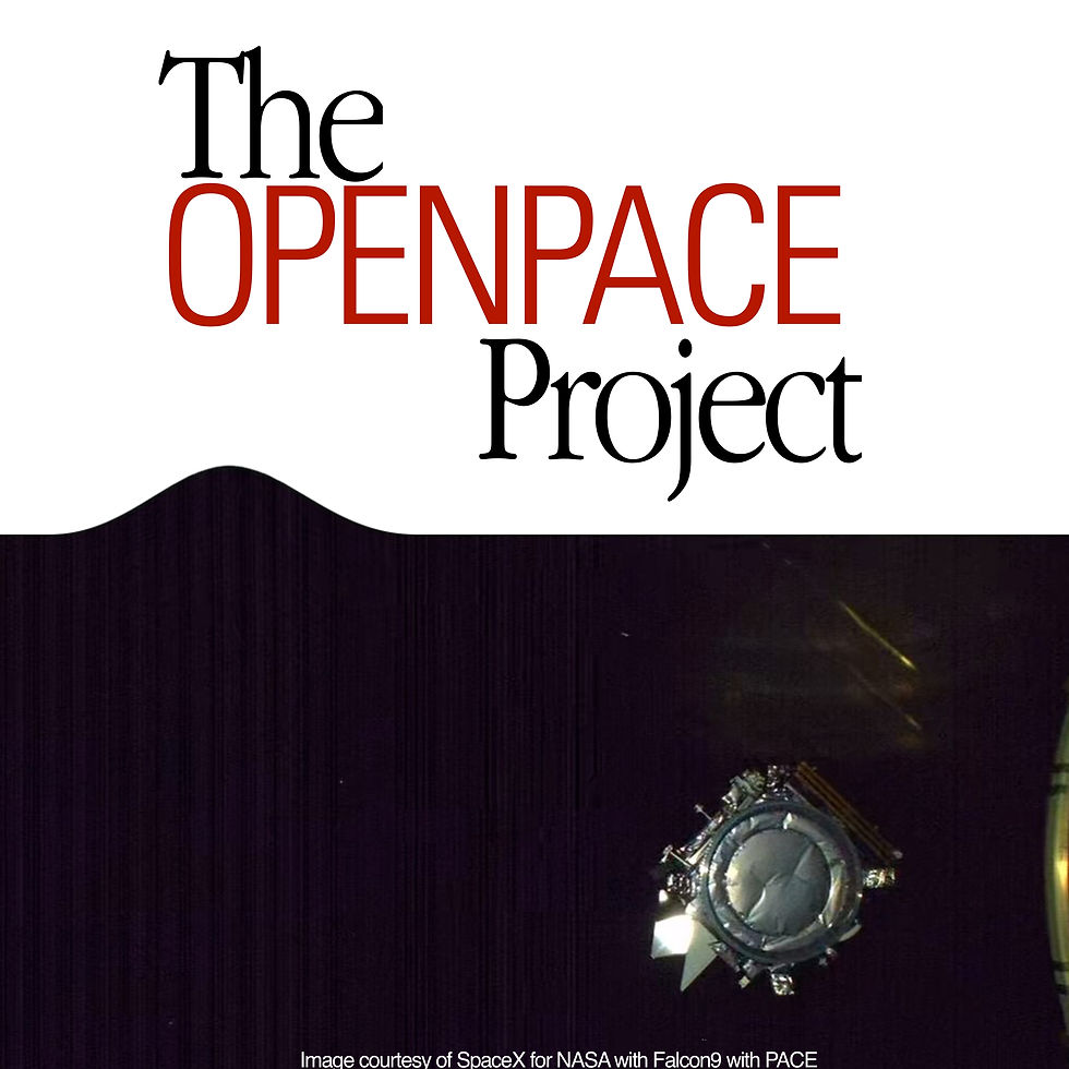
by: Anurag Guha (for OCI), Rajat Nayak (for Algorithms section)

We are ready to explore the sea and the sky with PACE, which has a really really cool pair of glasses called the Ocean Color Instrument (OCI). It will understand and collect precise ocean color data. But wait, there’s more! PACE also has two special polarimeters that can understand how sunlight dances through clouds, aerosols, and the ocean. Together, they will reveal secrets about sunlight and the ocean like never before. Doesn’t PACE seem like a science superhero? Let’s explore it further!
So, how does PACE actually gather all this amazing data we’ve been talking about?
Let’s start with the sky! The PACE satellite flies high above, collecting data about the entire ocean and atmosphere. But it doesn’t work alone—special sensors work together to validate and track global data!
So, why does the color of the ocean even matter?
When the ocean turns deep blue, it means there isn’t much of planktons hanging around. But when the waters turn greener, that’s when the magic happens! It means tiny plants called phytoplankton are at work. These little guys soak up sunlight with their green pigment, chlorophyll, to turn carbon dioxide into energy. They’re not just important—they’re the base of the entire marine food web! That means even the huge whales depend on these tiny ocean farmers for survival.
Phytoplankton are fighting climate change and we want to keep a close eye on these mini ocean heroes to see how they’re doing. To do that, we have the PACE!
Why should you be excited about our super cool OCI and polarimeters?
Meet the Ocean Color Instrument (OCI) – the most advanced tool ever built by NASA for exploring the ocean’s color! This can detect light from ultraviolet to infrared. With its powerful rotating telescope, it’ll capture super clear images and help us study those phytoplankton. By knowing more about these little ocean farmers, we can protect marine ecosystems, manage fisheries, and even spot harmful algae!
PACE also has two amazing "polarimeters," SPEXone and HARP2, which can see how sunlight changes when it hits clouds or particles in the air. This will help us understand how clouds form and how air pollution affects the planet. By teaming up, OCI and the polarimeters will give us a better look at the ocean and atmosphere, helping us predict weather, climate, and air quality like never before!
OCI In-Depth

PACE's primary sensor, the Ocean Color Instrument (OCI), is a highly advanced optical spectrometer that will be used to measure properties of light over portions of the electromagnetic spectrum. It will enable continuous measurement of light at finer wavelength resolution than previous NASA satellite sensors, extending key system ocean color data records for climate studies.
The color of the ocean is determined by the interaction of sunlight with substances or particles present in seawater such as chlorophyll, a green pigment found in most phytoplankton species. By monitoring global phytoplankton distribution and abundance with unprecedented detail, the OCI will help us to better understand the complex systems that drive ocean ecology.
The OCI was built at Goddard Space Flight Center (GSFC). It consists of a cross-track rotating telescope, thermal radiators, along with half-angle mirror and solar calibration mechanisms. The OCI's tilt will help avoid sun glint and single science detector design will inhibit image striping. Its signal-to-noise ratios will rival or exceed previous ocean color instruments.
The OCI features:
Cross track, 360° continuous rotating telescope
Two slit grating hyperspectral spectrographs (ultraviolet to visible & visible to near-infrared, NIR)
Fiber-coupled multiband filter spectrograph (NIR-to shortwave-infrared) Credits- https://pace.oceansciences.org/oci.htm (we recommend everyone to fully view this)
SPEXone In-Depth

PACE's SPEXone instrument is a multi-angle polarimeter. It measures the intensity, Degree of Linear Polarization (DoLP) and Angle of Linear Polarization (AoLP) of sunlight reflected back from Earth's atmosphere, land surface, and ocean.
Aerosols are small solid or liquid particles suspended in the air that affect climate directly through interaction with solar radiation. Aerosols affect climate indirectly by changing the micro- and macro-physical properties of clouds. According to the Intergovernmental Panel on Climate Change, aerosols are the largest source of error in quantifying the radiative forcing of climate change. SPEXone will enable measurements of optical and micro-physical properties of aerosols with unprecedented detail and accuracy.
SPEXone is being developed by a Dutch consortium consisting of SRON Netherlands Institute for Space Research (SRON) and Airbus Defence and Space Netherlands (Airbus DS NL), supported by optical expertise from the Netherlands Organisation for Applied Scientific Research. SRON and Airbus DS NL are responsible for the design, manufacturing and testing of the instrument. The scientific lead is in the hands of SRON. SPEXone is a public-private initiative funded by the Netherlands Space Office (NSO), the Netherlands Organization of Scientific Research (NWO), SRON, and Airbus DS NL.
SPEXone will feature:
A compact three-mirror segmented telescope assembly (patented by the consortium) to gather light from 0°, ±20° and ±50° (at satellite level) and direct the light towards a common entrance slit of a spectrometer.
Polarization Modulation Optics (PMO) to encode the state of linear polarization in the intensity spectrum as a sinusoidal modulation.
A compact and lightweight all-reflective imaging grating spectrometer.
Credits- https://pace.oceansciences.org/spexone.htm (we recommend everyone to fully view this)
HARP2 In-Depth

HARP2 (Hyper-Angular Rainbow Polarimeter #2) is a wide angle imaging polarimeter designed to measure aerosol particles and clouds, as well as properties of land and water surfaces. The amount and type of particles in suspension in the atmosphere are relevant to applications pertaining to health effects, cloud life cycle and precipitation, climate, etc. HARP2 will combine data from multiple along track viewing angles (up to 60), four spectral bands in the visible and near infrared ranges, and three angles of linear polarization to measure the microphysical properties of the atmospheric particles including their size distribution, amount, refractive indices and particle shape.
HARP2 is a contributed instrument to the PACE mission, designed and built by UMBC's Earth and Space Institute. Credits- https://pace.oceansciences.org/harp2.htm (once again, we recommend everyone view this)
The Mission Architecture of PACE

The Algorithms
Deep Blue Algorithm
https://earth.gsfc.nasa.gov/climate/data/deep-blue (for Deep Blue Algorithm)
Deep Blue uses measurements made by satellite instruments orbiting the Earth to determine the amount of aerosols in the atmosphere, and the properties of those aerosols. 'Aerosols' is a catch-all term covering particles suspended in the atmosphere, including but not limited to desert dust, smoke, volcanic ash, industrial smog, and sea spray. Improving our understanding of aerosols is important for reasons related to Earth's climate, human health, and ecology, as well as many others.
For PACE, ranges supported:

Dark Target Algorithm
https://darktarget.gsfc.nasa.gov/ (for Dark Target Algorithm)
The effect of aerosols is one of the greatest sources of uncertainty in climate modeling. Aerosols vary in time in space and can lead to variations in cloud microphysics, which impact cloud radiative properties and climate. The Dark-Target (DT) aerosol retrieval algorithm is applied to multispectral satellite sensor data, and derives aerosol properties including aerosol optical depth (AOD) over land and ocean, as well as spectral AOD and aerosol size parameters over ocean. Products of the DT retrieval are used to develop global and regional aerosol climatology, to study the interaction of aerosols with clouds, and for air quality assessments and forecasts.
Before the DT algorithm which was designed for MODIS can be applied to new sensors many factors must be taken into account including:
Sensor differences such as available wavelengths, width of sensor bands, and sensitivity
Calibration and characterization differences
Sampling differences including time of day, orbital coverage, orbital height and measurement geometry
Pixel selection including cloud and other masking
Data aggregation and averaging to produce global and/or gridded products
For PACE, ranges supported:

Apparent Visible Wavelength
https://www.earthdata.nasa.gov/apt/documents/apparent-visible-wavelength/v1.0#abstract (for Apparent Visible Wavelength Algorithm)
Apparent Visible Wavelength (AVW) is a simplistic spectral classification derived from satellite-based ocean color information. Changing values equate to a change in the ocean's color, with lower values representing more clear water and higher values representing more turbid water. This tool is useful as it draws information from all available channels of ocean color instruments, and allows for visualisation and monitoring of small changes in highly complex data. It has been adapted across all the ocean color instruments, to allow for continuity and long term monitoring of the aquatic ecosystems.
Phytoplankton Carbon
https://oceancolor.gsfc.nasa.gov/resources/atbd/cphyt/ (for Phytoplankton Carbon Concentration Algorithm)
This algorithm returns the concentration of the phytoplankton carbon (carbon_phyto) in mg m-3, calculated using an empirical relationship derived from field data between analytical measurements of carbon_phyto and particulate backscattering coefficient (Graff et al. 2015). Implementation of the algorithm is contingent on the availability of particulate backscattering coefficient at 470 nm, that is currently derived using Generalized Inherent Optical Property (GIOP, Werdell et al., 2013) model output bbp_443_giop and bbp_s_giop
Cloud Mask
https://oceancolor.gsfc.nasa.gov/resources/atbd/atmospheric/cloud-mask/ (for Cloud Mask Algorithm)
This algorithm defines whether a given pixel is likely to be partially or fully covered by a cloud ("cloudy") or not ("cloud-free" or "clear"). This is a basic input to other elements of a satellite data processing chain: most algorithms that derive atmospheric or surface properties either deal with only cloud-free cases, or only cloudy cases. While some algorithms have their own internal cloud mask; this product constitutes a cloud mask which can be used stand-alone or as an input to those downstream algorithms. It has two main outputs for each pixel processed:
A categorical cloud mask, in which a pixel is defined to be "confidently cloudy", "probably cloudy", "probably clear", or "confidently clear", and;
A binary cloud mask. In this latter case each pixel which is either "confidently cloudy" or "probably cloudy", or is adjacent (within one pixel and and/or across-track in the satellite swath) to one or more pixels with those classifications, is marked as cloudy. Other pixels are marked as clear.
Cloud Optical Properties
https://oceancolor.gsfc.nasa.gov/resources/atbd/atmospheric/cop/ (for Cloud Optical Properties)
It provides the cloud optical depth (COD) and cloud effective radius (CER). COD is a dimensionless optical measure related to the total extinction of light by cloud droplets at visible wavelengths. CER (in microns) is a description of cloud particle size – specifically, the ratio of the third to the second moment of the droplet size distribution.
From these (and knowledge of cloud thermodynamic phase, i.e. whether the cloud is composed of liquid water or ice crystals) the cloud water path (CWP) – known as liquid water path (LWP) or ice water path (IWP) dependent on phase – is also provided. CWP (in gm-2) is the total mass of cloud water in the atmospheric column. These quantities are colloquially referred to as the "cloud optical properties" data products, although only COD is an optical metric. Further, COD is synonymous with cloud optical thickness (COT)
The algorithm is an implementation of the optical properties component (Platnick et al., 2003, 2017) of the CHIMAERA retrieval code (Wind et al., 2020), which has been applied widely to retrieve cloud optical properties from multispectral satellite measurements. The current implementation is to MODIS measurements as a proxy for the PACE OCI.
Cloud Phase
https://oceancolor.gsfc.nasa.gov/resources/atbd/atmospheric/cloud-phase/ (for Cloud Phase Algo)
This product provides the thermodynamic phase of a cloudy pixel: that is, whether the clouds are composed of liquid water, or of ice crystals. While some clouds may be mixed phase, this product reports the optically-effective phase, which is generally that of the uppermost portion of the cloud.
Because liquid droplets and ice crystals have very different scattering and absorption properties, this quantity is an input to several other downstream algorithms (e.g. cloud optical properties, cloud top pressure).
The consensus report of the first PACE Science Team (Platnick et al., 2018) discussed pathways toward an OCI cloud phase retrieval algorithm. This contained results of sensitivity analyses of OCI information content to cloud properties, as an extension of previous work by Coddington et al (2012), with similar approaches also being applied to ground based observational data (Jäkel et al. 2013).
The anticipated algorithm will use OCI near-infrared (nIR) and shortwave infrared (swIR) bands from 865 to 2260 nm channels. These show characteristic spectral features based on particle size and phase. In particular, the combination of bands at 1615, 2135 and 2260 nm significantly increases the skill at discriminating phase, due to differences in the magnitudes and slopes of spectral absorption of liquid water vs. ice across this spectral range. Specifically, relative to a liquid droplet, an ice particle of a given size absorbs 200% more at 1615 nm, 30% more at 2135 nm, and 50% less at 2260 nm.
It is still to be determined whether this will be processed as a stand-alone algorithm, or the appropriate spectral channels will be used to augment different cloud property retrieval algorithm(s) to determine the appropriate cloud phase. This product will be evaluated against suitable ground-based and spaceborne data sets, such as lidar with depolarization capabilities and/or other sensors in combination (e.g. Riedi et al. 2001; Hu et al., 2009; Marchant et al., 2016).
It is expected that PACE’s multiangle polarimeters will be able to provide cloud phase information (van Diedenhoven et al., 2012), which will also be used as a comparison data source. Thermal phase retrievals from polar-orbiting and geostationary sensors (e.g. VIIRS, GOES) will also be used.
for PACE:

Cloud Top Pressure

https://oceancolor.gsfc.nasa.gov/resources/atbd/atmospheric/ctp/ (for Cloud Top Pressure)
This product provides the cloud top pressure (CTP) and cloud top height (CTH) for cloudy pixels. These indicate the vertical location in the atmosphere of the top of the cloud. CTP is provided in hPa (equivalent to mbar), and CTH in km. CTP is retrieved and CTH is derived from it using an ancillary pressure profile.
Many heritage approaches use thermal infrared bands to retrieve cloud altitude (e.g. Baum et al., 2012; Poulsen et al., 2012), although such channels will not be available on the PACE OCI. Because of this, a new research algorithm, using oxygen (O2) A-band measurements, has been developed. A-band CTP approaches have been applied to several instruments, e.g. GOME (Rozanov and Kokhanovsky, 2004), TropOMI (Loyola et al., 2018), MERIS (Fischer et al., 1997), and EPIC (Yang et al., 2019).
Across the visible spectrum, clouds are bright features with fairly spectrally flat reflectance characteristics. Oxygen is well-mixed in the atmosphere (i.e. the column amount is proportional to total atmospheric pressure) and has strong absorption features at several locations, including the A-band centered near 760 nm. These absorption features cause a darkening of the signal seen by a satellite sensor at the top of atmosphere (TOA). The darkening is dependent primarily upon the altitude and brightness (determined by particle size, phase, and water content) of a cloud; a higher, brighter cloud will block more of the below-cloud absorption, resulting in a brighter and spectrally-flatter TOA signal (Heidinger and Stephens, 2000). Other factors such as surface albedo, surface pressure, cloud vertical structure, and the presence of aerosol features, can also be important.
The research algorithm uses four bands from the OLCI sensor, centered just outside (753.75 nm) and at various locations inside (761.25, 764.375, and 767.4 nm) the O2 A-band with differential absorption strengths. OCI will have bands with similar positions and widths. These are used to simultaneously retrieve the cloud optical depth (COD), CTP, and surface albedo using an Optimal Estimation approach. Surface albedo is subject to a strong a priori constraint from an ancillary data base. Other properties, such as cloud effective radius, vertical structure, and aerosol profiles, are held fixed.
LAND
https://darktarget.gsfc.nasa.gov/algorithm/land (for LAND algo)
Tucker, C. J. (1979), Red and photographic infrared linear combinations for monitoring vegetation, Remote Sens. Environ., 8:127-150. The goal of the land algorithm is to use the lookup table to determine the conditions that best mimic the MODIS-observed spectral reflectance, and retrieve the associated aerosol properties (including AOD [τ] and fine aerosol weighting [η]). The difficulty lies in making the most appropriate assumptions about both the surface and atmospheric contributions. The mechanics of the land algorithm are shown in the flowchart below.
The land algorithm retrieves aerosol properties in three channels simultaneously (the two visible channels, plus the 2.12 µm channel) and assumes that the 2.12 µm channel contains information about coarse mode aerosol as well as the surface reflectance. The surface reflectance in the visible is a function of the surface reflectance at 2.12 µm, and a function of the scattering angle and the “greenness” of the surface in the mid-IR spectrum (NDVI-like parameter based on 1.24 µm and 2.12 µm channels).
Like the ocean algorithm, the land algorithm is an inversion, but takes only three (nearly) independent observations of spectral reflectance (0.47, 0.65 and 2.1 µm) to retrieve three (nearly) independent pieces of information. These include total t at 0.55 µm (τ 0.55), Fine (model) Weighting at 0.55 µm (η 0.55 ), and the surface reflectance at 2.1 µm (ρs2.12). The land algorithm is based on look-up table (LUT) approach, i.e., radiative transfer calculations are pre-computed for a set of aerosol and surface parameters and compared with the observed radiation field. The algorithm assumes that one fine-dominated aerosol model and one coarse-dominated aerosol model (each may be comprised of multiple lognormal modes) can be combined with proper weightings to represent the ambient aerosol properties over the target. Spectral reflectance from the LUT is compared with MODIS-measured spectral reflectance to find the best match. This best fit is the solution to the inversion.
The collection 6.1 update includes a modification to retrieve aerosol properties over urban areas. Any retrieval area identified as more than 20% urban area based on the MODIS land cover type product (MCD12Q1) uses one of four sets of urban surface reflectance relationships to retrieve aerosol properties.

SFREFL (Surface Reflectance)

For an overview, we recommend viewing the following:
For Viewing and Accessing PACE data:
Select Provisional or Testing (L3/4 OB.DAAC access)
Select PACE-OCI
Indexes in many cases for Provisional/Testing aren't published and one might need to wait longer in that regard.
For PACE and associated events
Multiple 2024 events, and more to come later
Training Courses included
Many such courses are free of cost and multilingual
Meet the PACE data validation team!
Comments